Share Public Engagement Summaries on Facebook
Share Public Engagement Summaries on X (formerly Twitter)
Share Public Engagement Summaries on Linkedin
Email Public Engagement Summaries link
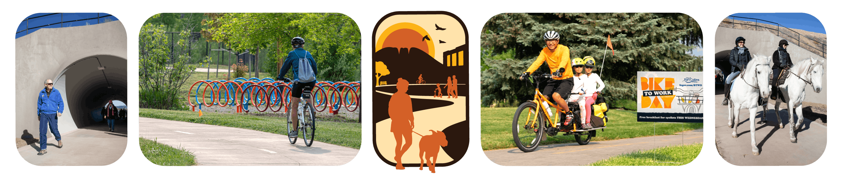
The first phase of community outreach for the Strategic Trails Plan took place in March - May 2024, and included a variety of engagement tools and opportunities. Feedback was centered around the community's experiences, challenges, opportunities, and values related to the paved trail system. Additional phases of public engagement occurred throughout 2024, and into 2025.
A few key takeaways and themes that emerged from the public engagement were:
Phase I (Marcy - May 2024)
-
Trails for all. Everyone should have access to trail opportunities and the planning and design of trails should account for the great variation in abilities, culturalContinue reading
The first phase of community outreach for the Strategic Trails Plan took place in March - May 2024, and included a variety of engagement tools and opportunities. Feedback was centered around the community's experiences, challenges, opportunities, and values related to the paved trail system. Additional phases of public engagement occurred throughout 2024, and into 2025.
A few key takeaways and themes that emerged from the public engagement were:
Phase I (Marcy - May 2024)
-
Trails for all. Everyone should have access to trail opportunities and the planning and design of trails should account for the great variation in abilities, cultural backgrounds, modes of movement, and diversity of the community.
-
Community Connections. Priority connections for the community include neighborhoods, schools, parks, natural areas, and linkages to other trails.
-
Interconnected Network. Trails are a key component of the City’s system of facilities for active transportation and recreation and should be considered congruently with those facilities to provide a seamless and safe user experience.
Phase II (May - November 2024)
-
Complement On-Street Infrastructure - Trails should complement, not replace on-street bicycle infrastructure. In many areas of the city, the existing and proposed on-street infrastructure is low-stress.
-
Balancing Trail Access - Homeowner concern for loss of privacy if trails are developed within irrigation ditch corridors and very close to homes.
-
New Trails in the Northeast - Strong support for investment in NE Fort Collins trails and interim facilities while future development processes unfold.
-
Trail Safety Education - Need for additional trail safety education regarding user behaviors/etiquette.
-
Partnerships Produce Results - Collaborative trail development in Northern Colorado has resulted in the successful completion of numerous projects that connect Fort Collins to neighboring communities. The City should continue to leverage partnerships for a coordinated approach to network development.
Phase III (December – June 2025)
-
Trails as a mechanism for environmental stewardship: Trail development should integrate environmental analysis and best practices to understand potential impacts to habitat and sensitive ecosystems and eliminate or mitigate negative impacts through close collaboration with the Natural Areas Department and compliance with applicable federal, state, and city regulations.
-
Continue proactive community engagement: The planning process for the STP has successfully engaged community members. On-going communication with the community on trail-related topics should continue beyond plan adoption.
-
Expand outreach focus: Trail safety and etiquette education should expand to include community awareness on paved trail impacts to sensitive habitats and wildlife, such as bicycle volumes and speeds. Outreach should provide ways to avoid or mitigate these impacts.
Share Focus Areas of the STP on Facebook
Share Focus Areas of the STP on X (formerly Twitter)
Share Focus Areas of the STP on Linkedin
Email Focus Areas of the STP link
-
Alignment: Ensure the STP aligns with recommendations from supporting plans including, Parks and Recreation Master Plan, Active Modes Plan, Natural Areas Strategic Framework Plan, and Our Climate Future.
-
Equity of Existing & Future Trails: The STP will review proposed trails and trail spurs and provide recommendations on new trails to meet the needs of Fort Collins’ expanding population, ensuring equity across the system.
-
Community Input: During the STP process, staff will utilize a diverse array of communication tactics to engage internal and external stakeholders, including the formation of a community working group to steer the plan’s scope, policy, and proposedContinue reading
-
Alignment: Ensure the STP aligns with recommendations from supporting plans including, Parks and Recreation Master Plan, Active Modes Plan, Natural Areas Strategic Framework Plan, and Our Climate Future.
-
Equity of Existing & Future Trails: The STP will review proposed trails and trail spurs and provide recommendations on new trails to meet the needs of Fort Collins’ expanding population, ensuring equity across the system.
-
Community Input: During the STP process, staff will utilize a diverse array of communication tactics to engage internal and external stakeholders, including the formation of a community working group to steer the plan’s scope, policy, and proposed action items.
-
Safety & Accessibility: The STP will review current safety outreach practices and ordinances and provide recommendations to promote a culture of safety among users of the trail system.
-
Maintenance: The STP will analyze existing trail conditions, consolidate current and new maintenance concerns, and assign priorities to improvements needed.
-
Design and Construction Standards: The STP will review existing design standards and provide recommendations to ensure trail design standards and associated amenities are contemporary, relevant, and meet the future needs of Fort Collins’ growing population.
-
Development Review: The STP will provide recommendations for Land Use Code updates relative to new developments and provide recommendations on requirements for trail easement, cost shares, construction, maintenance, and trail connections.
-
Irrigation Ditch Compatibility: The STP will evaluate the feasibility of installing trails on, along, or across irrigation ditches.
-
Funding: The STP will review and summarize existing trail funding strategies and identify new funding opportunities to potentially accelerate the growth of trail construction.
Share StoryMap on Facebook
Share StoryMap on X (formerly Twitter)
Share StoryMap on Linkedin
Email StoryMap link
Want to learn more about the history of the paved trail system in Fort Collins? Visit our StoryMap to journey through the development of the City's recreational trail system.
Note: This StoryMap was created by the Geospatial Centroid at Colorado State University, in partnership with staff from Park Planning & Development.

 About the Strategic Trails Plan

 Final Adopted STP_July 2025.pdf (73.8 MB) (pdf)
 Individual Appendices