
Safer Streets Northwest
Project Summary
Safer Streets Northwest is a study aiming to improve travel safety and comfort along some of Fort Collins’ busiest streets.
The goal of this study: To make these streets safer, more convenient and more enjoyable for everyone—whether you’re walking, biking, rolling or driving. Funded by the federal Safe Streets and Roads for All (SS4A) program, this project supports the City of Fort Collins' broader goals around traffic safety, carbon neutrality and active transportation.
The Safer Streets Northwest study builds on the City’s Vision Zero Action Plan, Active Modes Plan and Transportation Capital Improvements, focusing on major streets in northwest Fort Collins and creating a plan for safety upgrades, street redesigns and long-term improvements. This study's outcomes will guide future investments, funding applications and projects.
Why Now?
In 2023 the City made the Vision Zero commitment to eliminate fatal and serious injury crashes by 2032. While the City has long prioritized traffic safety through enforcement and design, fatal and serious crashes still happen. This study is a proactive step toward safer streets for all.
Community Engagement
Your voice matters. We're committed to ensuring this study reflects the needs of the Fort Collins community. This study will reflect input from across Fort Collins, with a focus on reaching a diverse mix of residents.
The first two engagement phases took place from June-September 2025 and engaged over 500 community members.
In Phase 1 (June), we gathered input on which streets and segments in Northwest Fort Collins should be prioritized for safety improvements. Combining the input we received with the results of our crash analysis and review of past plans and studies, we identified three high-priority corridors: Shields Street, Taft Hill Road, and Laurel Street.
In Phase 2 (July-September), we collected targeted feedback on the three high-priority corridors.
We heard that the community is concerned about safety and connectivity, citing speeding, turning conflicts, long signal waits, and inadequate infrastructure such as narrow bike lanes and missing sidewalks.
There is a critical need to reduce speeding, provide safer crossings, and build bike lanes that offer greater protection for people riding bicycles/scooters.
-
Laurel Street Concept Planning
Share Laurel Street Concept Planning on Facebook Share Laurel Street Concept Planning on X (formerly Twitter) Share Laurel Street Concept Planning on Linkedin Email Laurel Street Concept Planning linkThe City is planning safety improvements for Laurel Street from Shields Street to College Avenue. This project is moving forward in coordination with an upcoming road resurfacing, which presents an opportunity to implement multimodal upgrades. Through this project, the City will plan improvements that make walking, biking, taking transit and driving along Laurel Street safer. Analysis of current conditions is nearing completion, with concept alternatives development expected to begin late summer 2025. The City will ask for public input on these alternatives in summer to fall 2026.

What We’ve Learned So Far
Traffic analyses show that Laurel Street has more space for vehicles than needed for traffic volumes, making it a strong candidate for a “road diet” that could reallocate space for safety and multimodal improvements.
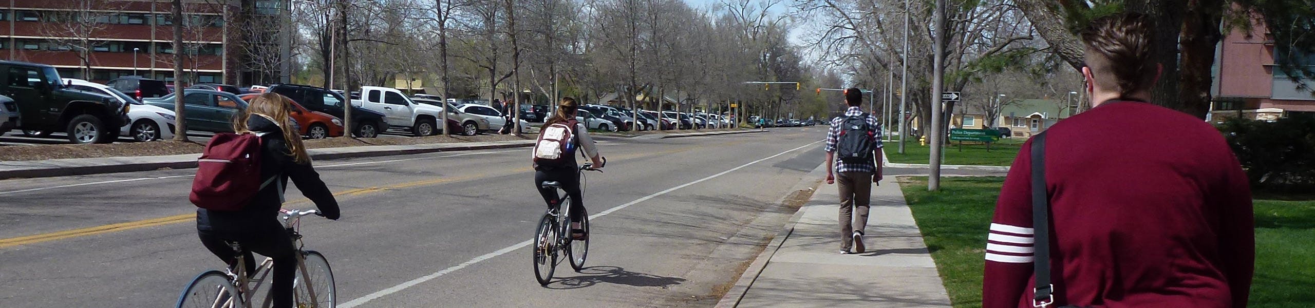
Laurel Street’s configuration and bike facilities change along the corridor, with some blocks offering protected bike lanes but most without any protection or separation, creating an inconsistent experience for people biking.
The corridor sees high levels of pedestrian activity, reflecting its role as a link between Colorado State University and surrounding businesses and homes.
From 2020-2024 there were 148 reported crashes along Laurel Street. Of those, eight involved someone walking or biking, and two resulted in a death or serious injury.
All pedestrian- and bicycle-involved crashes during that time occurred at signalized intersections, showing that even with traffic signals, turning conflicts remain a key safety issue.
Who's Listening
-
Active Modes Manager

Email cgeary@fortcollins.gov -
Transportation Planner

Email rruhlen@fortcollins.gov -
Civil Engineer III
DWEmail dwillett@fortcollins.gov